2 other products in the same category:
-

Carta’s New...
$60.00
View
-

The Sacred...
$120.00
View
OUT OF STOCK
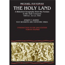
By: Michael Avi-Yonah, Anson F. Rainey
This revised and newly published book covers the historical geography of the Holy Land from 536 B.C. to A.D. 640. Part I deals in chronological order with the historical factors which have affected the map of the Holy Land during this period. In part II the boundaries of each one of the territorial units making up the country are analyzed in detail, with the available evidence assessed in each case. Part III deals with the development of the Roman road system, attempts a summary of the economic geography of the country by regions, and the composition of the population, as reflected in literary and epigraphical sources.
In conclusion an attempt is made to estimate the total population of the country in the Roman and Byzantine periods.
Twenty four sketch maps illustrate the detailed text.
Language: English
Hard Cover, 256 pages, 6 x9 in. (15 x22.5 cm)
Featuring:
Maps
Toponymic Index
Subject Index
ISBN: 965-220-502-8
Weight: 540g (18.25 oz)
Shopping Cart
Categories
-
Bible Studies
- Battles
- Bible History
- Biblical Judges
- Biblical Prophets
- Digital
- Divided Kingdom
- Exodus and Conquest of Canaan
- Herodian period
- Historical Geography
- Introductory Maps
- Jerusalem
- Jesus
- Kingdom of Judah
- Kings
- New Testament
- Old Testament
- Patriarchs
- Bible Wall Maps & Charts
- The United Monarchy
- Tribes of Israel
- Religion
- Christianity
-
History
- Archaeology
- Bible History
- Jerusalem
- New Testament
- Old Testament
- Tribes of Israel
- History
- Assyrian Empire
- Babylonian Empire
- Bar Kokhba revolt
- Battles
- Bronze Age
- Canaanite Period
- Divided Kingdom
- Early Bronze Age
- Exodus and Conquest of Canaan
- Greek Empire
- Hasmoneans
- Hellenistic period
- Herodian period
- Introductory Maps
- Iron Age
- Israel and Judah
- Jewish Revolt against the Romans
- Kingdom of Judah
- Maccabees
- Persian Empire
- Roman Conquest
- The United Monarchy
- Islam
- Israel Guides
- Religion
- Wall Maps & Charts
- Middle Ages
- Israelite Period
- Judaism
- Historical Geography
- Understanding
- Archaeology
- Jerusalem
- Hebrew Script
- Guides & Maps
- eBooks
- New titles


