8 other products in the same category:
-

Special...
$138.00
View
-

Bound For Exile
$44.80
View
-

UNDER THE...
$51.80
View
-

The Raging...
$88.00
View
-

The Raging...
$58.80
View
-

The Carta...
$60.00
View
-

The Carta...
$60.00
View
-

Illustrated...
$59.95
View
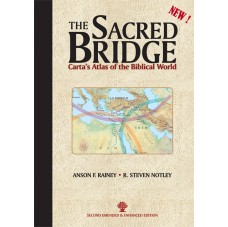
By: Anson F. Rainey, R. Steven Notley
REVIEW BY PASTOR ABRAM K.J -THE BEST BIBLE ATLAS EVER?
SECOND EMENDED & ENHANCED EDITION
Documenting over 3,000 years of East Mediterranean history, this detailed volume is an up-to-date depiction of Biblical history and geography by way of the ancient sources with original texts and translations from native languages incorporated into the narrative of the Atlas.
This is the first Atlas to adopt the modern approach to the study of the Levant as a geographical/historical entity. Emphasis throughout the current work is on the ancient written sources - every ancient passage is interpreted firsthand, from its native language. Archaeological evidence has been taken into account whenever it is relevant.
The logical geographical unit the “Levant” in spite of its lack of homogeneity in some physical and ecological respects is a land bridge that saw the influx of many races and ethnic groups. The chronological scope of this volume includes peoples of the third millennium BCE down to the Greeks, the Itureans and the Nabateans in the Hellenistic and Roman periods.
New Testament geography, especially that of the Gospels, is interpreted in light of new understanding resulting from discoveries such as the Dead Sea Scrolls. Refreshing insights serve to define geographical terms used in the New Testament.
Detailed references to the most recent scholarly works on ancient texts consulted and cited for each period of ancient history.
DO YOU KNOW THE ANSWERS? (FOUND IN THE SACRED BRIDGE)
1) What are the dimensions and disciplines of historical geography?
2) Who were the ‘Apîru and why did Prof. Rainey consider them a social phenomenon?
3) Where is the real location of Bethel?
Find the answers to these and countless other questions relating to historical geography of the Bible in The Sacred Bridge: Carta's Atlas of the Biblical World.
Language: English
Hard Cover, 448 pages, 9 x12.5 in. (22.8 x31.7 cm)
Featuring:
Maps
Illustrations
Photographs
Full Color
Chronological Table
Index
Bibliography
ISBN: 978-965-220-849-1
Weight: 2.05 kg (4.5 pounds)
- The Sacred Bridge
Table of contents - 00472_26-27-S.pdf
Sample pages
Shopping Cart
Categories
-
Bible Studies
- Battles
- Bible History
- Biblical Judges
- Biblical Prophets
- Digital
- Divided Kingdom
- Exodus and Conquest of Canaan
- Herodian period
- Historical Geography
- Introductory Maps
- Jerusalem
- Jesus
- Kingdom of Judah
- Kings
- New Testament
- Old Testament
- Patriarchs
- Bible Wall Maps & Charts
- The United Monarchy
- Tribes of Israel
- Religion
- Christianity
-
History
- Archaeology
- Bible History
- Jerusalem
- New Testament
- Old Testament
- Tribes of Israel
- History
- Assyrian Empire
- Babylonian Empire
- Bar Kokhba revolt
- Battles
- Bronze Age
- Canaanite Period
- Divided Kingdom
- Early Bronze Age
- Exodus and Conquest of Canaan
- Greek Empire
- Hasmoneans
- Hellenistic period
- Herodian period
- Introductory Maps
- Iron Age
- Israel and Judah
- Jewish Revolt against the Romans
- Kingdom of Judah
- Maccabees
- Persian Empire
- Roman Conquest
- The United Monarchy
- Islam
- Israel Guides
- Religion
- Wall Maps & Charts
- Middle Ages
- Israelite Period
- Judaism
- Historical Geography
- Understanding
- Archaeology
- Jerusalem
- Hebrew Script
- Guides & Maps
- eBooks
- New titles


