Wall Maps & Charts There are 10 products.
Wall Maps & Charts
-
-

-

-
 $59.95 View
 -

-
-
 $19.95 View
 -
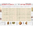 Available
Hebrew Scripts - A Carta Wall Chart
-
 Available
Carta Wall Maps JESUS and the APOSTLES
Shopping Cart
product
(empty)
Categories
-
Bible Studies
- Battles
- Bible History
- Biblical Judges
- Biblical Prophets
- Digital
- Divided Kingdom
- Exodus and Conquest of Canaan
- Herodian period
- Historical Geography
- Introductory Maps
- Jerusalem
- Jesus
- Kingdom of Judah
- Kings
- New Testament
- Old Testament
- Patriarchs
- Bible Wall Maps & Charts
- The United Monarchy
- Tribes of Israel
- Religion
- Christianity
-
History
- Archaeology
- Bible History
- Jerusalem
- New Testament
- Old Testament
- Tribes of Israel
- History
- Assyrian Empire
- Babylonian Empire
- Bar Kokhba revolt
- Battles
- Bronze Age
- Canaanite Period
- Divided Kingdom
- Early Bronze Age
- Exodus and Conquest of Canaan
- Greek Empire
- Hasmoneans
- Hellenistic period
- Herodian period
- Introductory Maps
- Iron Age
- Israel and Judah
- Jewish Revolt against the Romans
- Kingdom of Judah
- Maccabees
- Persian Empire
- Roman Conquest
- The United Monarchy
- Islam
- Israel Guides
- Religion
- Wall Maps & Charts
- Middle Ages
- Israelite Period
- Judaism
- Historical Geography
- Understanding
- Archaeology
- Jerusalem
- Hebrew Script
- Guides & Maps
- eBooks
- New titles
