21 other products in the same category:
-

Understandin...
$19.95
View
-

Understandin...
$19.95
View
-

Bible...
$14.95
View
-

Understandin...
$19.95
View
-

Understandin...
$19.95
View
-

Greatness...
$50.00
View
-

Carta’s...
$9.95
View
-

Teaching...
$35.00
View
-

Landscape,...
$32.95
View
-

Carta’s New...
$60.00
View
-

The Carta...
$60.00
View
-

The Sacred...
$120.00
View
-

Carta’s...
$10.00
View
-

War and...
$17.95
View
-

Carta’s...
$59.00
View
-

Understandin...
$19.95
View
-

Understandin...
$19.95
View
-

The Raging...
$84.00
View
-

Josephus —...
$60.00
View
-

Understandin...
$19.95
View
-

The Raging...
$88.00
View
By: F.F. Bruce
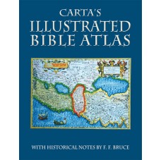
From the Second Millennium B.C. to the First Century A.D., this compact and lavishly illustrated Bible Atlas, with its many maps, illuminates the biblical period and provides the reader with a visual background to the beauty of the Holy Scriptures. Now revised, it will serve another generation in gaining a better image of the Holy Writ.
Renowned and much admired scholar F. F. Bruce had spent a lifetime studying and teaching the Bible. Having published many scholarly works, he graciously agreed to contribute the historical background to accompany this basic set of maps. Augmented by plans, illustrations and photographs, Carta’s Illustrated Bible Atlas has been serving teachers and pupils for decades.
In addition to the pages covering all the biblical periods in chronological order, we have now prefaced it with a map of Bible Lands today and a physical map of the same area. The chronological chart is another important tool to view the various relationships between the kingdoms and empires of each period. Rounding off the picture are a map of modern Israel, a satellite view of the Holy Land and a map of the Old City of Jerusalem showing the major excavations where remains from Bible times have been unearthed.
Language: English
Soft Cover, 32 pages, 9 x12 in. (22 x30 cm)
Featuring:
Index
Maps
Full Color
Illustrations
ISBN: 978-965-220-812-5
Weight: 160g (5.6 oz.)
Shopping Cart
Categories
-
Bible Studies
- Battles
- Bible History
- Biblical Judges
- Biblical Prophets
- Digital
- Divided Kingdom
- Exodus and Conquest of Canaan
- Herodian period
- Historical Geography
- Introductory Maps
- Jerusalem
- Jesus
- Kingdom of Judah
- Kings
- New Testament
- Old Testament
- Patriarchs
- Bible Wall Maps & Charts
- The United Monarchy
- Tribes of Israel
- Religion
- Christianity
-
History
- Archaeology
- Bible History
- Jerusalem
- New Testament
- Old Testament
- Tribes of Israel
- History
- Assyrian Empire
- Babylonian Empire
- Bar Kokhba revolt
- Battles
- Bronze Age
- Canaanite Period
- Divided Kingdom
- Early Bronze Age
- Exodus and Conquest of Canaan
- Greek Empire
- Hasmoneans
- Hellenistic period
- Herodian period
- Introductory Maps
- Iron Age
- Israel and Judah
- Jewish Revolt against the Romans
- Kingdom of Judah
- Maccabees
- Persian Empire
- Roman Conquest
- The United Monarchy
- Islam
- Israel Guides
- Religion
- Wall Maps & Charts
- Middle Ages
- Israelite Period
- Judaism
- Historical Geography
- Understanding
- Archaeology
- Jerusalem
- Hebrew Script
- Guides & Maps
- eBooks
- New titles


